contact us

Use the form on the right to contact us.

You can edit the text in this area, and change where the contact form on the right submits to, by entering edit mode using the modes on the bottom right.


123 Street Avenue, City Town, 99999

(123) 555-6789

email@address.com


You can set your address, phone number, email and site description in the settings tab.
Link to read me page with more information.

Blog for Victoria Bennett Beyer Photography

The photography blog of Victoria Bennett Beyer, featuring travel photographs from road trips across America and botanical photography of plants, flowers and leaves.

Filtering by Tag: road trip

Gros Morne National Park, Broom Point

Victoria Beyer

EASTERN CANADA ROAD TRIP 2019

Broom Point (24) FIX.jpg

I’ll never forget our trip to Broom Point in Gros Morne National Park, because it is where we first saw minke whales. There were a couple of them surfacing right off the point and we watched them for a while. Trying to guess where they will surface next and watching the top of the water for motion just never gets old. The interpretive staff identified them for us, but the whales were not close enough to get a good photo.

Broom Point (6) FIX.jpg
Broom Point (29) FIX.jpg

But why were we at Broom Point in the first place? Every summer for about 34 years, the Mudge family - three brothers and their families - would set up in the cabin (the white building) and use the area as a base for fishing lobster, cod and salmon. Today you can see all the equipment they used and learn about the process from knowledgeable local staff. Our guide was raised in a fishing family nearby and was able to answer all our questions. This exhibit really helped us understand what a labor-intensive activity this was, and just how important it was to not only the Mudge family, but many like them up and down Newfoundland’s coast.

Broom Point (37) FIX.jpg

The surrounding landscape was just gorgeous, and we had fun looking in the tide pools at the site.

Theodore Roosevelt National Park

Victoria Beyer

SEVEN WEEKS ACROSS AMERICA

Bison at TR NPS.jpg

We first visited Theodore Roosevelt National Park last summer when we briefly stopped at the highway visitor center on our way home from seeing the eclipse in Wyoming. Right away we were sorry we did not have more time to stay, but we were excited by the idea of returning. So when we began planning our epic summer road trip this year, we knew we wanted to make this park a priority.

2018-06 CCT Day _6595 FIX.jpg

It was the last stop on our seven-week road trip, but far from the least. It is comprised of three areas, linked by the Little Missouri River and Theodore Roosevelt’s love of this land. We began our trip in the South Unit, and later made our way to the North Unit where we spent most of our time. The road to the Elkhorn Ranch Unit is not RV-friendly, so we left that for another trip.

We were, however, surprised by the number of other visitors. When planning, we were told by park rangers that the North Unit campground was never full. However, it was when we arrived! Luckily there are several other campgrounds near the North Unit, so we were fine. Even so, the park was hardly what I’d call crowded, particularly when compared to all the other parks we had visited. It was refreshing to find a parking spot at every pull off, and to hike and see only two other groups.

2018-06 CCT Day _6562 FIX2.jpg

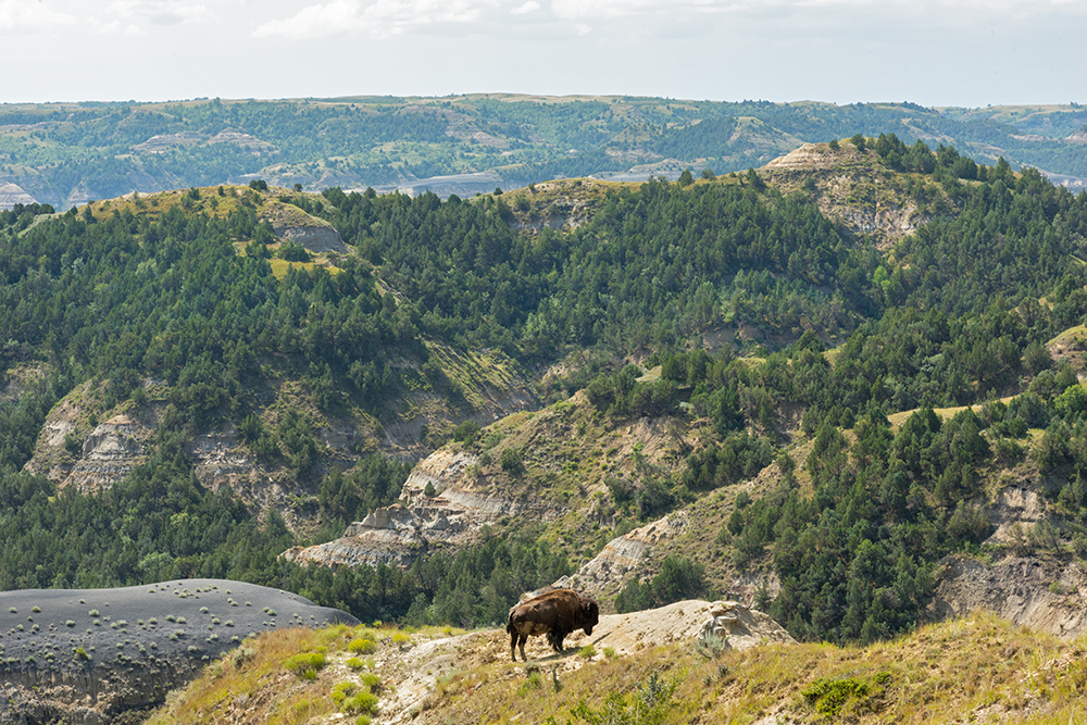
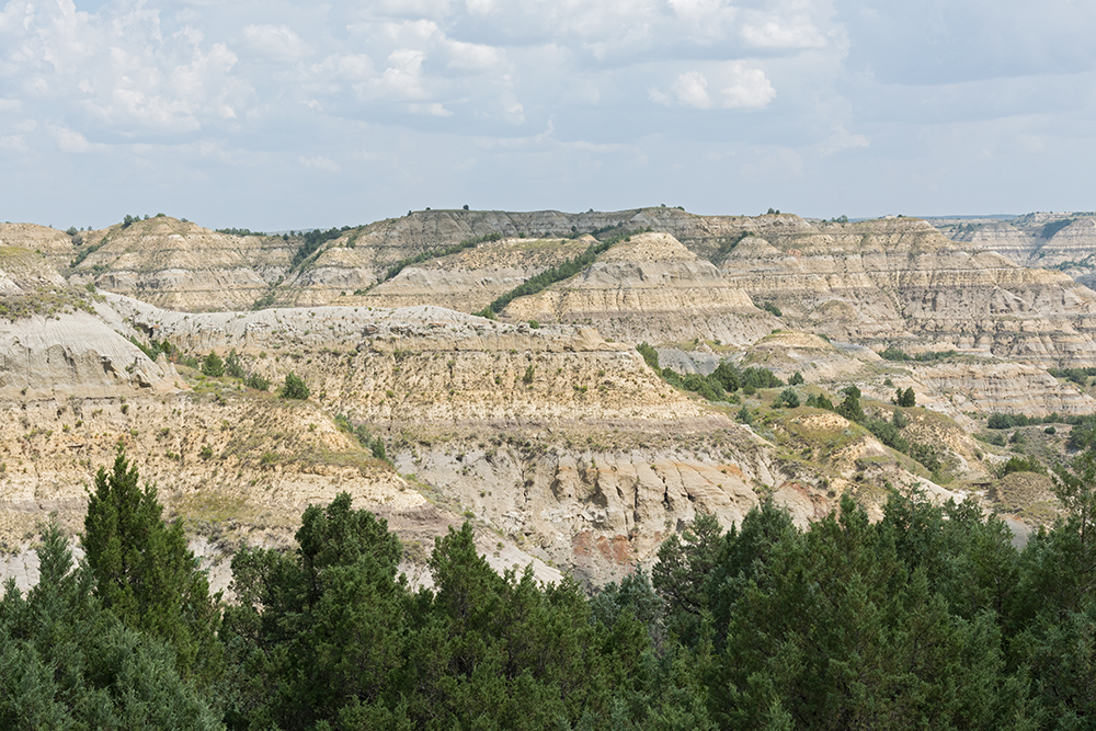
Some park Visitor’s Centers are so crowded that you just can’t wait to grab a map and get out of there. At the South Unit, which has the larger Visitor’s Center, we enjoyed talking to the rangers. One told us her favorite hike in the whole park was Caprock Coulee in the North Unit. The following day we headed out on this 4.2 mile hike - the longest my six-year-old ever did without getting carried at some point! It was such a varied trail, beginning in a grassland area that led to stone formations, including cannonball concretions, spherical stone structure that withstand erosion more than the surrounding rock. Then we hiked uphill through dense forests. We were surprised to see bison tracks here, having never imagined a bison pushing through thick brush along a narrow trail. Then we climbed up to where we could see the tops of the hills (as seen in the first image in this post). The view was beautiful, and we walked past a solo bison who was out on the bluff, seeming to admiring the scenery as well.

2018-08 SC 124 FIX.jpg
2018-06 CCT Day _6637 FIX.jpg
2018-08 SC 152 FIX.jpg

The trail then crossed the road, and we continued through scenery that was unlike anything we had previously hiked through. It was much drier here, and in places we were walking on rocks, only able to follow the path by the markers. The views over here were equally as stunning, especially when we were looking down at the Little Missouri River.

2018-06 CCT Day _6578 FIX.jpg
2018-06 CCT Day _6573 FIX CROP.jpg

We finished our hike and took the rest of the scenic drive through the North Unit. We saw an abundance of wildlife - more bison, deer, pronghorn, prairie dogs and wild horses. As we reached the far end, it was clear a storm was rolling in, and we drove back to our campsite in the rain - the only rain we encountered in seven weeks on the road.

2018-06 CCT Day _6699 FIX.jpg

North Cascades National Park

Victoria Beyer

SEVEN WEEKS ACROSS AMERICA

Diablo Lake

Diablo Lake

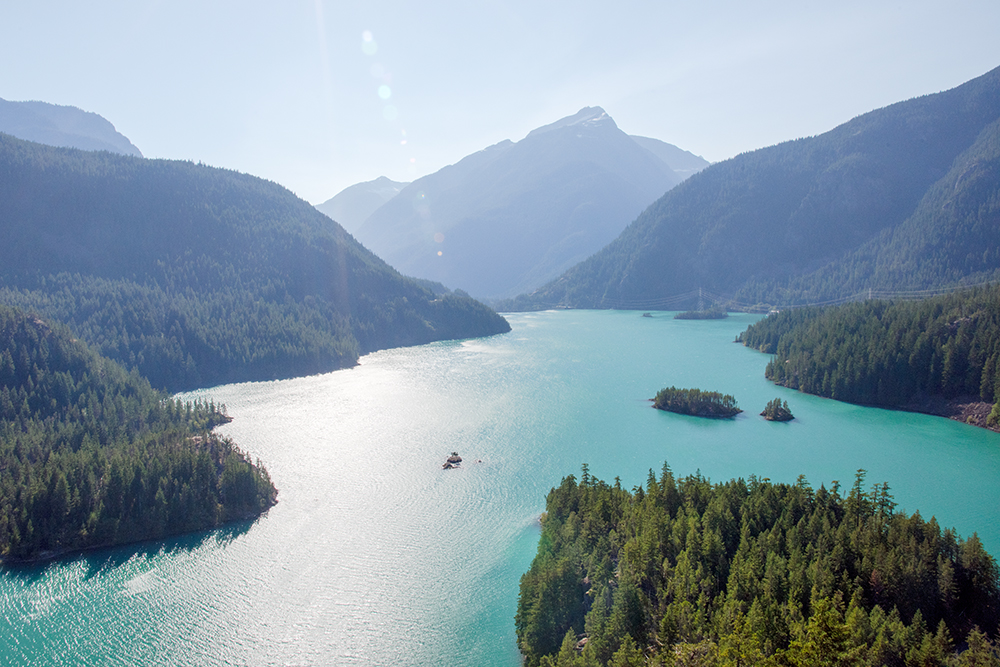
Everyone always asks me which National Park I want to go back to. I’d have to say North Cascades in Washington is at the top of that list. We only stayed a couple of nights and I feel like we just barely scratched the surface of what this park has to offer. We hiked from the campground to the small town of Newhalem, where we had a look around. It’s a company town, owned by Seattle City Light where employees of the Skagit River Hydroelectric Project live and work. The park encourages you to visit the Gorge Powerhouse, where you can actually go inside and see how it works. Seattle City Light actually has been promoting the area to visitors since the lakes were created nearly a hundred years ago. The waters of Gorge Lake, Diablo Lake and Ross Lake are a stunning turquoise color that really must be seen to be believed. You can get a good look at them from Hwy 20.

2018-06 North Cascades (23) FIX.jpg

Near the hydroelectric plant in Newhalem is this cool suspension bridge (with my even cooler little fox pictured). After crossing it you can walk up to Ladder Falls, which is lit at night with colored lights. Our bedtimes were a little too early for that, so we walked around it in the middle of the day. The Ladder Falls trail is surrounded by gardens that were clearly once very grand but could use a little more love these days. But it was just the right length of excursion for our family, given the heat we encountered. When my daughter is a little bigger I’d love to return to North Cascades and hike up into the mountains. There are so many trails here that look amazing.

Fort Ebey State Park

Victoria Beyer

SEVEN WEEKS ACROSS AMERICA

2018-06 CCT Fort Ebby (1) FIX.jpg

After we dropped Grandpa off in Port Angeles to catch a flight back home, we continued across Washington State. We rode a ferry to Whidbey Island, and spent the night at Fort Ebey State Park. There you can explore concrete structures that served as a battery and the concrete gun emplacements that were built to help defend the coast during WWII. The sun was setting as we pulled up so we set off right away to check them out. They were very popular with the kids from the nearby campground, and it was a delight to see big kids having as much fun playing outside as the little ones.

2018-06 CCT Fort Ebby (29) FIX.jpg

The old parade grounds face the ocean and the view of the sunset from there was just fantastic.

2018-06 CCT Fort Ebby (36) FIX.jpg

Olympic National Park - Hurricane Ridge

Victoria Beyer

Seven Weeks Across America

2018-06 CCT Hurricane Ridge (50) FIX.jpg

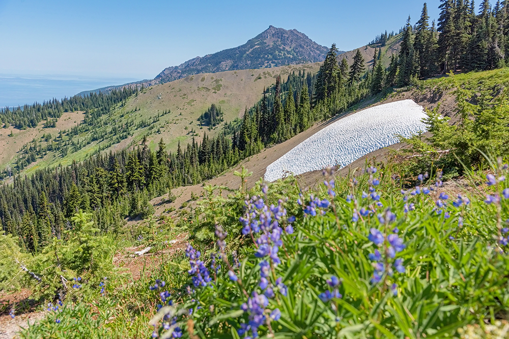
Several friends encouraged us to drive up to Hurricane Ridge at the northern end of Olympic National Park, and boy are we glad we took their advice. The panoramic view of the mountaintops was amazing. I REALLY wish I had a wide-angle lens so that I could have captured it properly. But just imagine this first image X 10 on all sides as you spin around. It was the most incredible view of the trip, for sure.

The blue patch at the top left is the Straits of Juan de Fuca and you can see Victoria, Canada, on the other side.

The blue patch at the top left is the Straits of Juan de Fuca and you can see Victoria, Canada, on the other side.

After a quick loop through the Visitor’s Center (heavy on the gift store) we took a nice hike. We were so lucky it was a clear day. We could see all the way north across the Straits of Juan de Fuca to Canada. As we walked through the meadows we came across a marmot colony, with several of the little guys peeking out from their burrows and trilling loudly.

2018-06 CCT Hurricane Ridge (62) FIX HORIZONTAL3.jpg

It’s a good thing we got there in the morning, because by noon when we left, the parking lot was packed and there was a solid line of cars doing the super-slow drive looking for spaces. The drive up and down the mountain was spectacular, as you might expect, and we were happy to see some wildflowers still blooming.

Point Cabrillo Lighthouse

Victoria Beyer

Seven Weeks Across America

2018-06 CCT Point Cabrillo (34) FIX.jpg

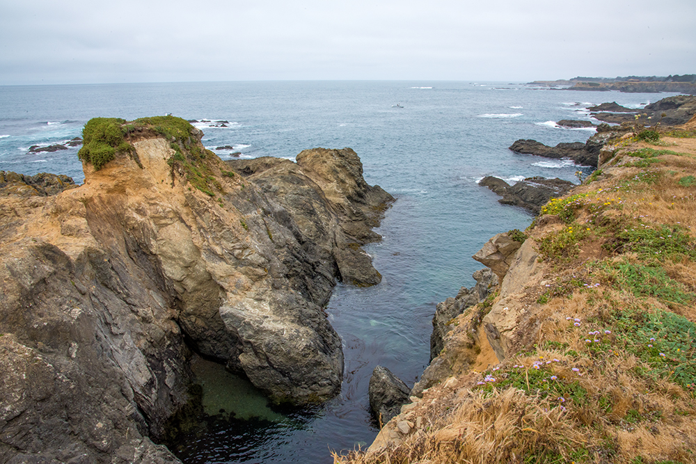
We headed up the coast from Santa Rosa, making our first stop at Point Cabrillo Lighthouse.  The first floor of the lighthouse serves as a museum.  You can also walk through the 1st Assistant Lightkeeper's house, which is decorated in period pieces.  There are beautiful trails around the headlands.  On our walk we saw some people diving off the wreck of the Frolic, which lies just off the coast.

2018-06 CCT Point Cabrillo (6) FIX2.jpg